Epic Mudslide Caught on Camera
Description: Various forms of mass wasting (e.g. creeps, slumps, landslides, mudflows) can be used to show that earth events can occur quickly or slowly. Mass wasting occurs as gravity acts on the soil and rock in an area. The amount of water in an area greatly affects the speed of the mass wasting.
Web Resources: Mudflow - Wikipedia, The Nelson Daily article

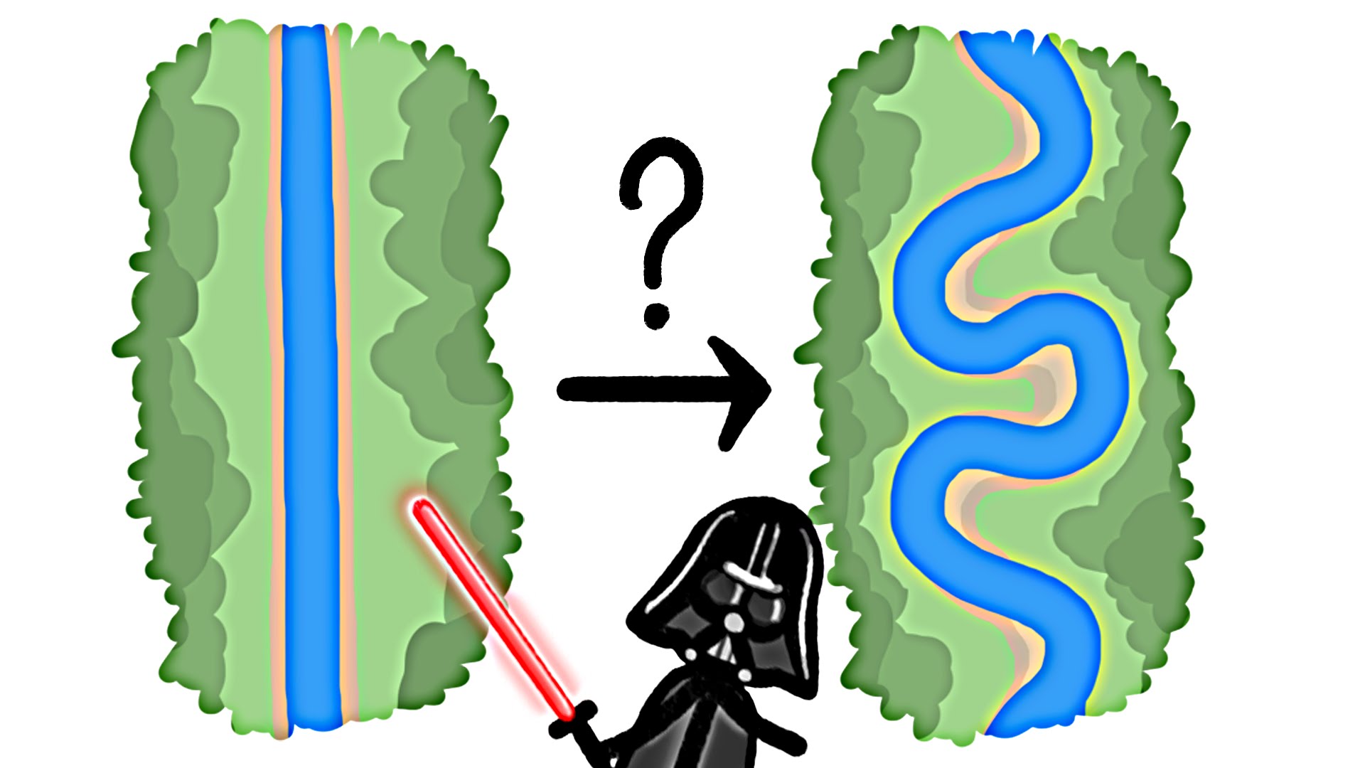
Why Do Rivers Curve
Description: A meandering river is a great example of a phenomenon of water changing the shape of land. When it is surrounded by steep rock a river rarely curves but when it open up in large valleys it will weave back and forth. Water on the outside of the river will travel faster and erode the land more quickly. Eventually it will curve too much and lose speed. A stream table can be used to model a meandering river.
Web Resource: Meander - Wikipedia

Augmented Reality Sandbox
Description: The augmented reality sandbox uses technology to visualize earth science processes. A camera measures the depth of the sand which is then projected with different colors on the sand by an overhead projector. The technology allows a topographic map to be manipulated in real time. Water can be added to the system to show the interaction between the geosphere and the hydrosphere.
Web Resource: Augmented Reality Sandbox - UCDavis

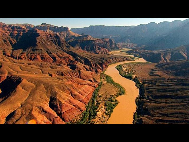
How Was The Grand Canyon Formed?
Description: The Grand Canyon is a mile-deep and was carved by the Colorado River over millions of years. This phenomenon shows how consistent weathering and erosion over a long period of time can radically shape the earth. Even though the work of the Colorado took millions of years this is relatively rapid compared to the billions of years of deposition revealed by the Canyon. A trip down into the Grand Canyon is literally a trip back in time written in the rocks.
Web Resources: Grand Canyon National Park, Grand Canyon - Wikipedia, Grand Canyon: Location, Formation & Facts - LiveScience